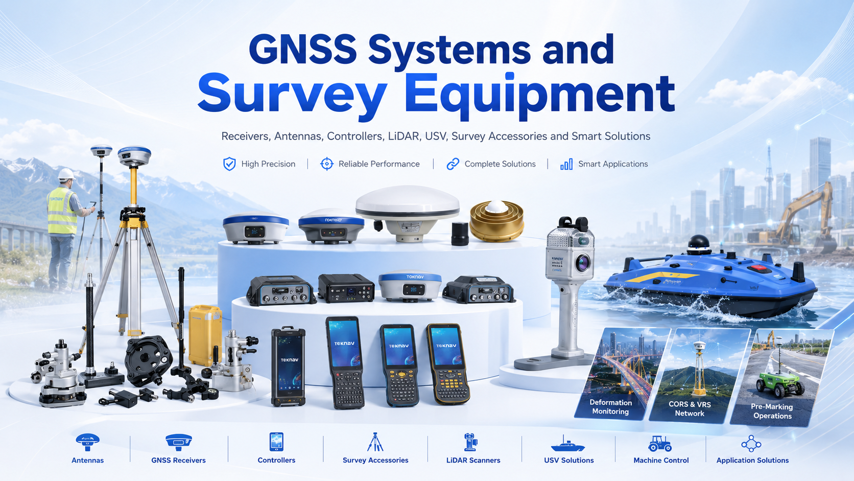
Toknav GNSS Systems and Survey Equipment
Authorized Toknav GNSS systems hub for RTK receivers, antennas, rugged GIS devices, monitoring, precision agriculture, SLAM mapping, Tboat USV, machine control, accessories, and application solutions.
- BrandToknav
- Categories9
- AgentEnmatech
Product Guide Built From The Local Catalogs
Enmatech Global provides Toknav positioning systems for surveying, mapping, monitoring, agriculture, construction machinery, mobile LiDAR, and marine operations. This hub gives search engines and buyers a clean product architecture: each category has a focused page, local catalog links, real product assets, and project-fit guidance.
Each product below connects the page content to the matching local catalog, user guide, image, or video stored in the website assets. Technical details should always be confirmed against the attached manufacturer PDF before procurement.
Project Support
- Model selection and configuration review.
- Catalog, user-guide, and accessory planning.
- Setup, handover, and operator orientation.
Products And Details
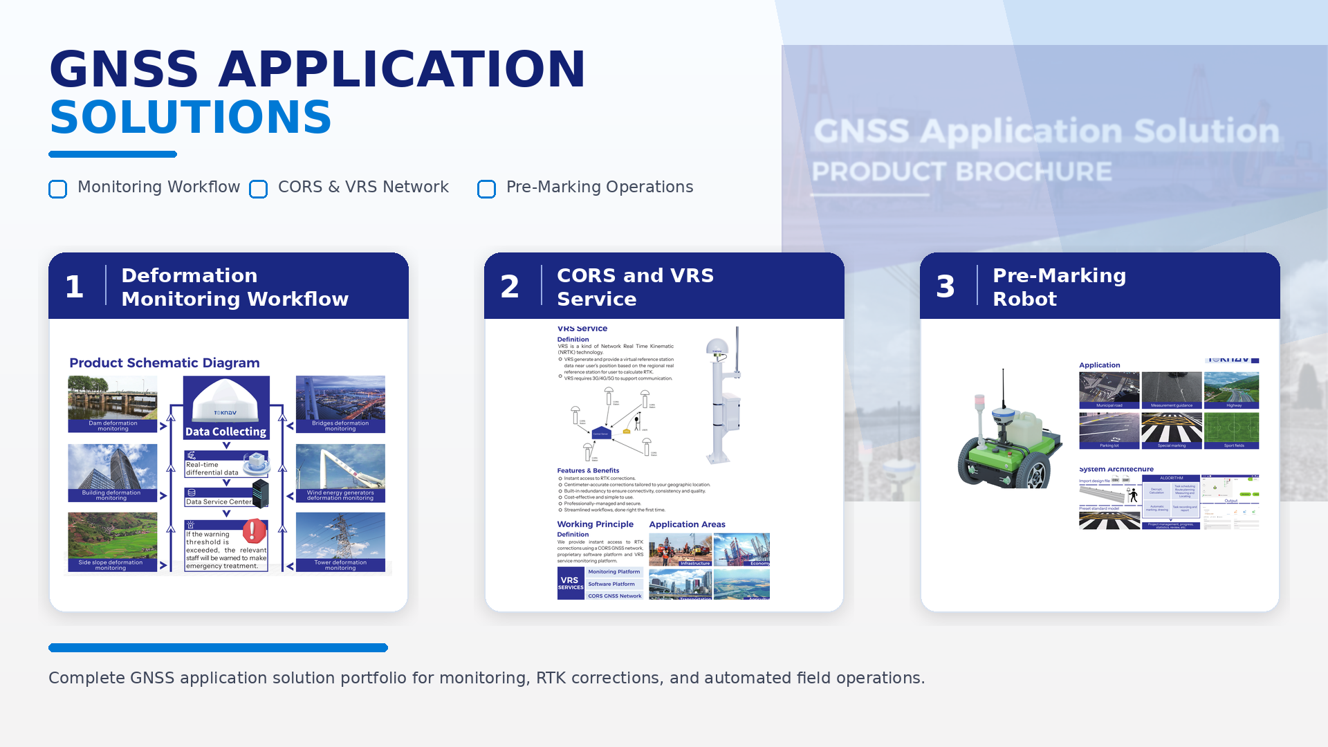
GNSS Application Solution
Integrated Toknav workflows for deformation monitoring, CORS/VRS service, and pre-marking robot applications.
View Details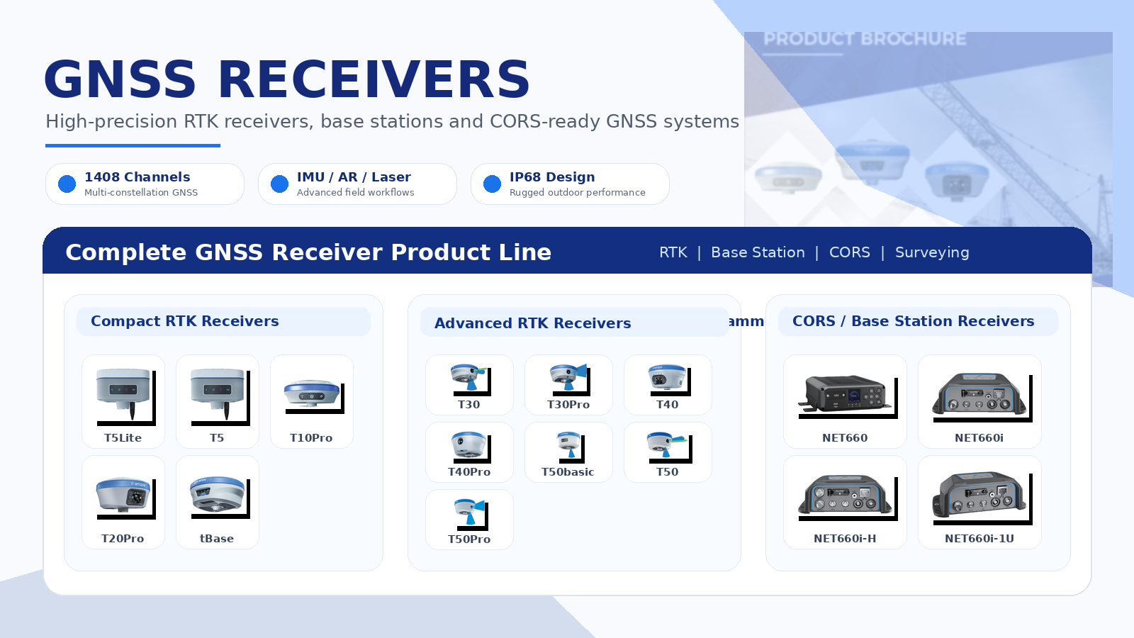
GNSS Receivers
RTK receivers, CORS stations, and professional positioning systems for surveying, layout, mapping, and monitoring.
View Details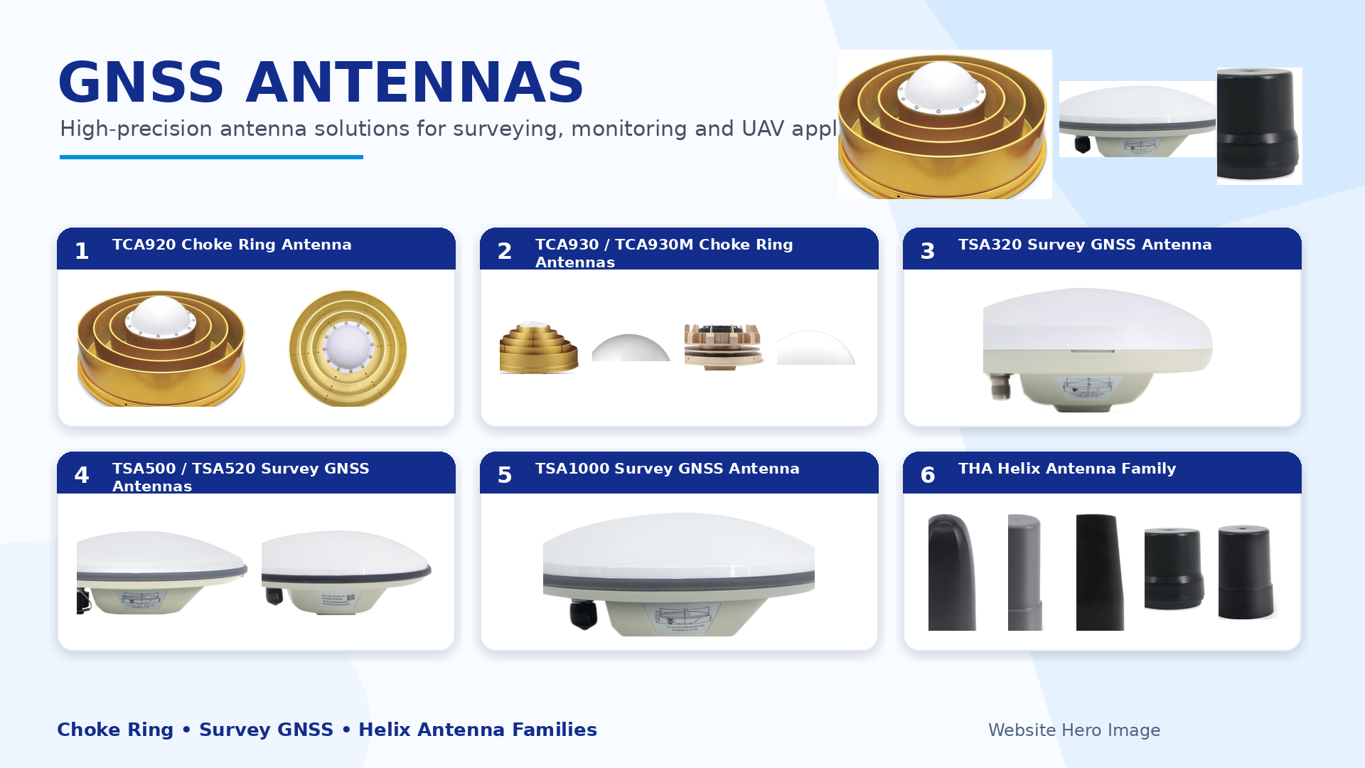
GNSS Antennas
Choke ring, survey GNSS, and helix antennas for stable signal tracking and accurate positioning.
View Details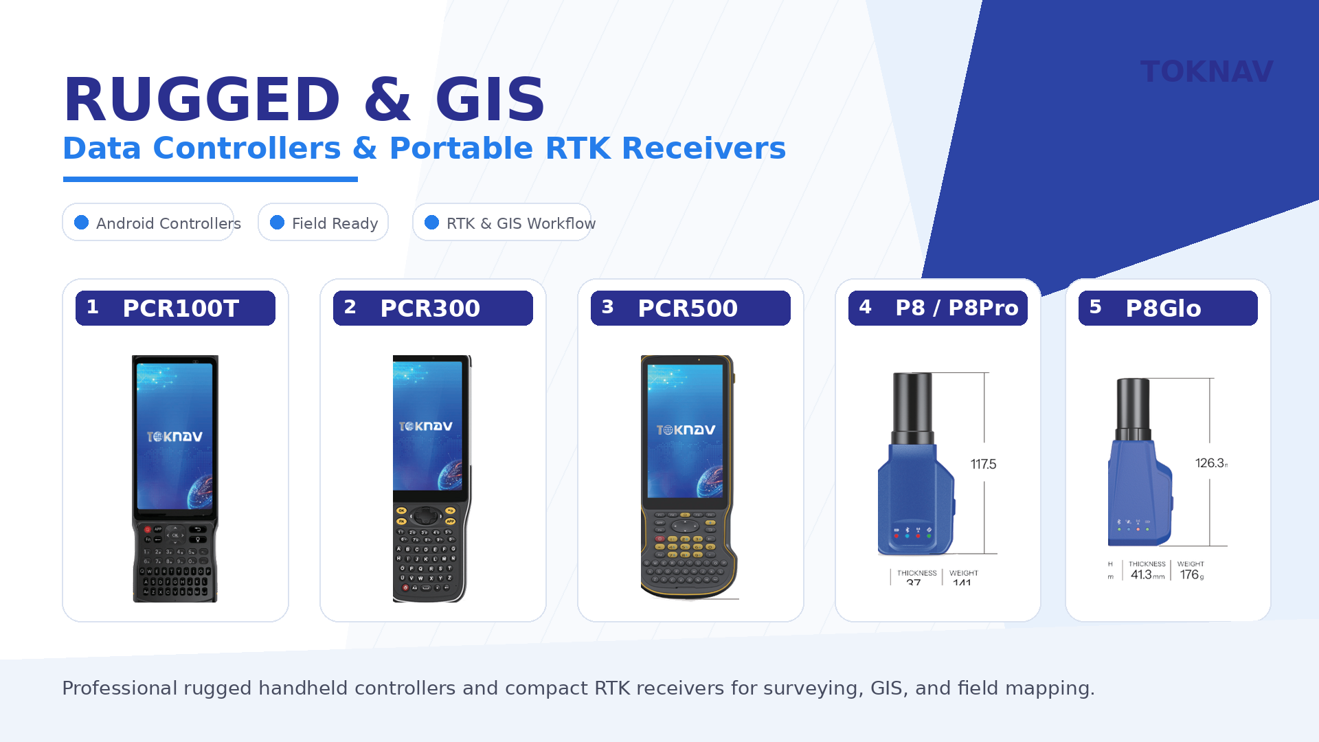
Rugged & GIS Devices
Rugged controllers and portable RTK/GIS devices for field mapping, inspections, and mobile data collection.
View Details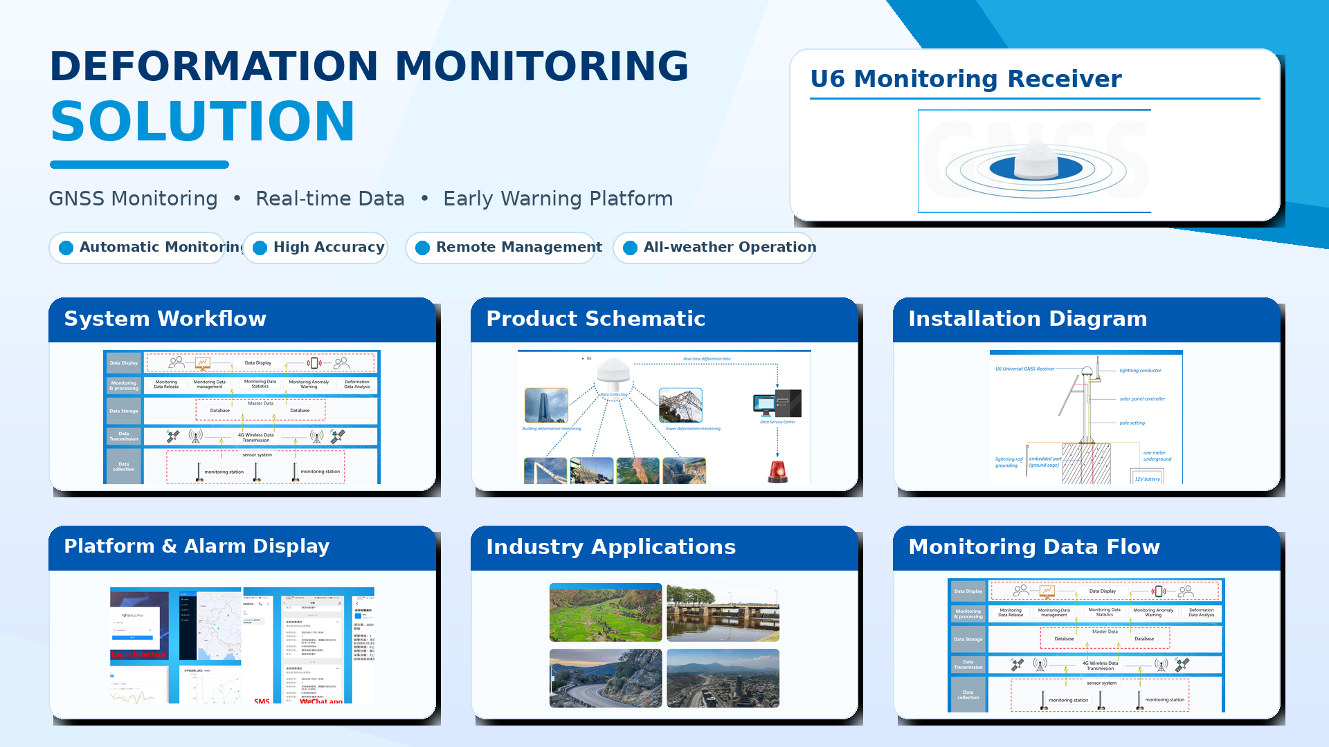
Deformation Monitoring
GNSS-based monitoring systems for slopes, bridges, dams, high-rise buildings, mines, and critical assets.
View Details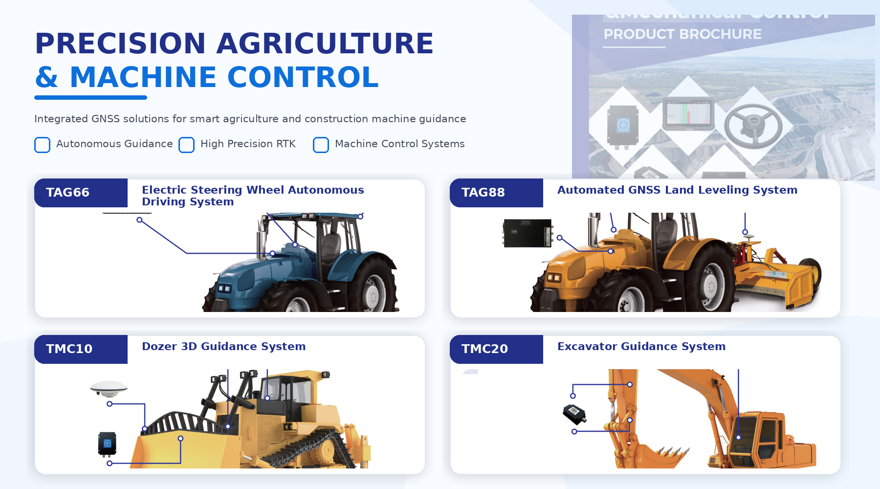
Precision Agriculture & Machine Control
Guidance and positioning systems for agriculture, machine control, land preparation, and productive field operations.
View Details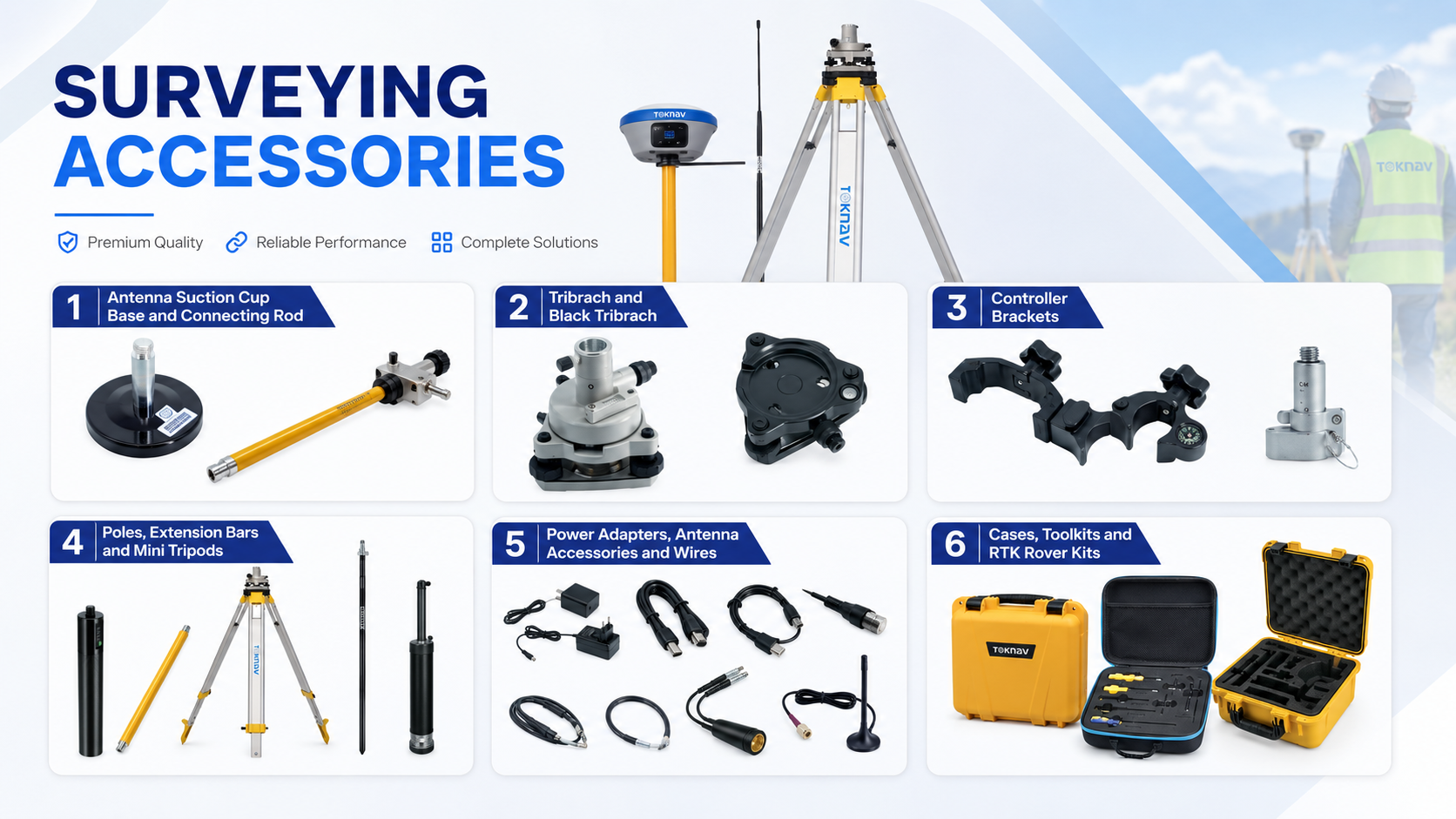
Survey Accessories
Tripods, tribrachs, poles, controller brackets, power adapters, antennas, cables, cases, and RTK kits.
View Details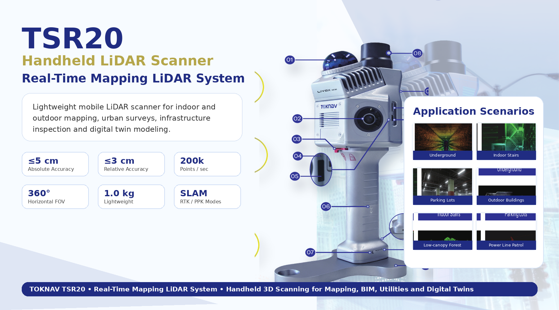
SLAM Mapping
Mobile SLAM and LiDAR mapping for indoor, underground, GPS-denied, and rapid 3D documentation workflows.
View Details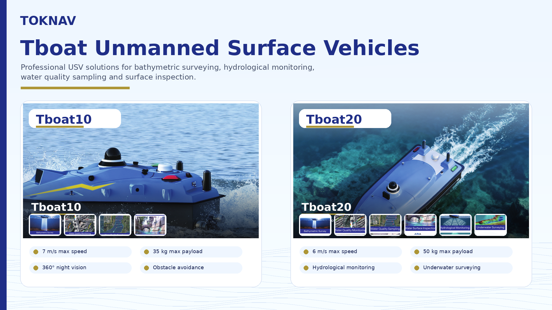
Tboat Hydrographic Survey Boat
Toknav Tboat10 and Tboat20 USV platforms for bathymetric survey, water sampling, inspection, and hydrographic monitoring.
View DetailsNeed a Toknav GNSS configuration?
Send the project scope, accuracy target, correction method, and site environment. Enmatech Global will help match the correct receiver, antenna, controller, software, and accessories.