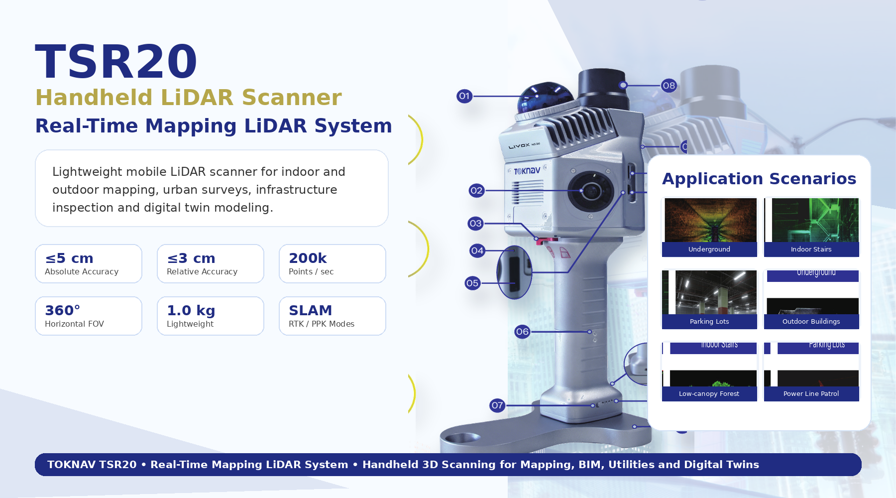
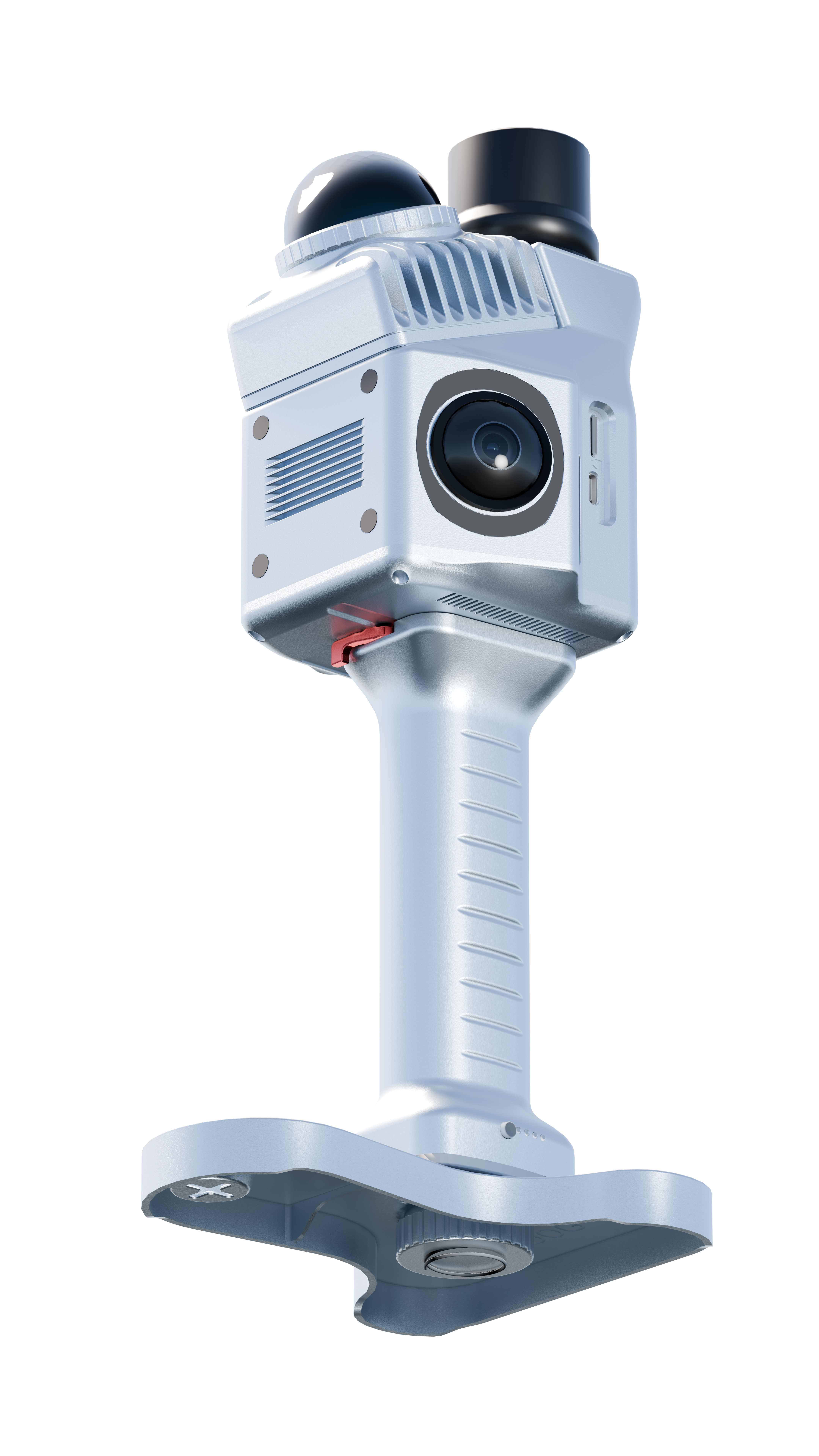
TSR20 Handheld LiDAR Scanner
Lightweight handheld mobile LiDAR scanner for real-time point cloud capture and professional mapping.
- Livox Mid-360 LiDAR with 40 m range at 10% reflectivity and 200,000 points per second.
- SLAM, RTK-SLAM, and PPK-SLAM mapping modes with 3 cm relative and 5 cm absolute accuracy noted in catalog.
- Dual 20MP cameras with 200-degree ultra-wide views for true-color 3D reality.
Source: TSR20 catalog and user guide.